FEMA flood maps are a crucial tool for understanding the risk levels associated with flooding in your area.
The maps are divided into three zones: A, B, and C, with Zone A being the highest risk area.
Zone A is the area most vulnerable to flooding, with a 1% annual chance of flooding.
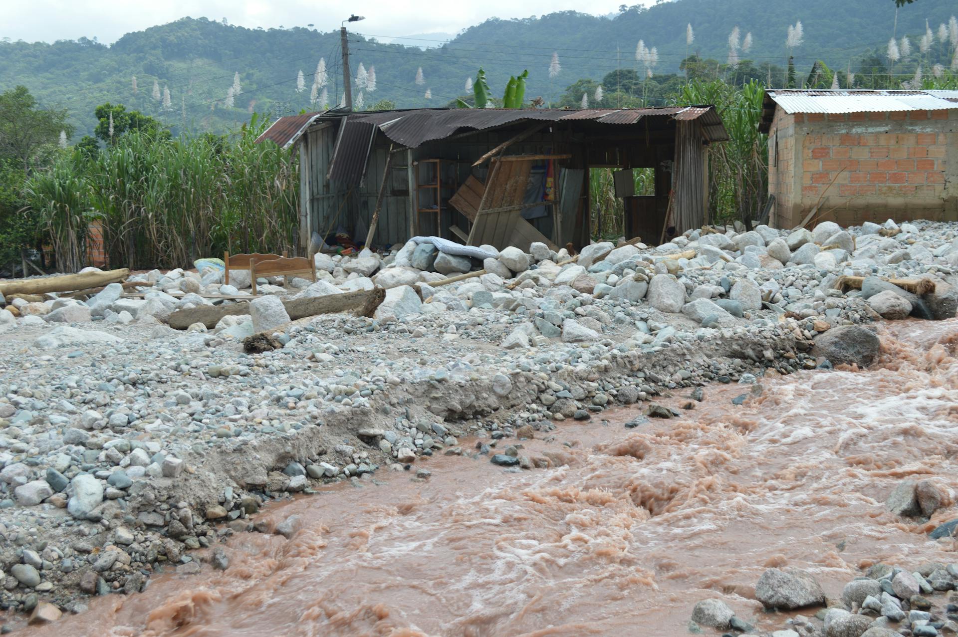
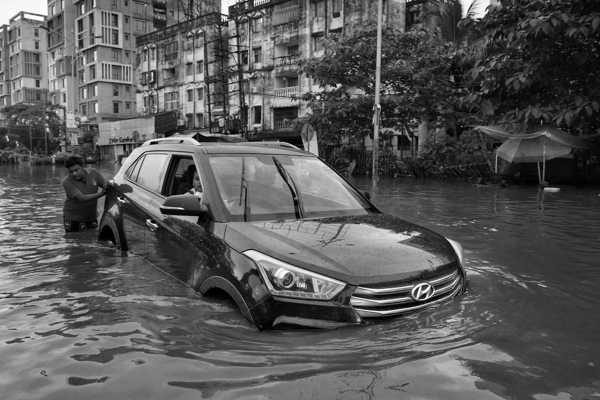
Flooding in Zone A can cause significant damage to homes and businesses, resulting in costly repairs and potential displacement.
Readers also liked: Ubs Maps
What Are FEMA Flood Maps?
FEMA flood maps show the probability of flood risk across a geographical area.
More than 20,000 communities in the United States have been placed into flood zone categories.
You can locate your flood map using your street address through the FEMA Flood Map Service Center.
FEMA produces Flood Insurance Rate Maps (FIRMs) which show the boundaries of each flood zone, dictating a property's flood status.
NFIP mapping started in 1968 and was performed through the '70's, nearly 50 years ago.
For your interest: Flood Insurance Rate Map Firm
Because land, development, and environment changes over time, the zones and FEMA maps have and will continue to change over time.
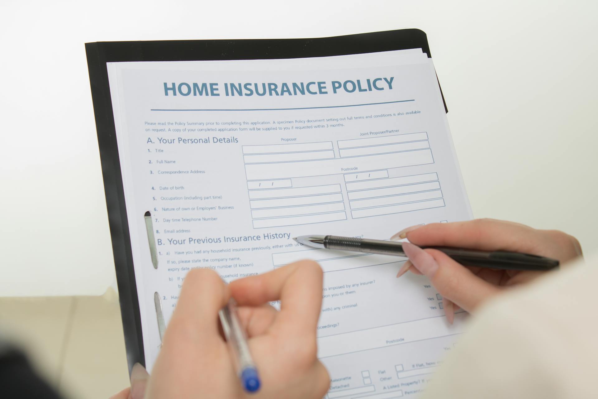
FEMA flood maps are used to determine a property's flood insurance requirements according to the National Flood Insurance Program (NFIP).
You can also assess all your current and future climate risks with the ClimateCheck property report.
Additional reading: Flood Risk Consulting
Understanding Risk Levels
Understanding Risk Levels is crucial when it comes to FEMA flood maps. Let's break it down into simple terms.
FEMA flood zones are categorized into three main risk levels: High Risk, Moderate Risk, and Low Risk.
High Risk areas have a 1% annual chance of flooding, also known as a 100-year flood. This means there's a 1 in 100 chance of flooding in a given year, and a 26% chance of flooding over 30 years. Flood insurance is mandatory for structures with mortgages from federally regulated or insured lenders in these areas.
For another approach, see: Condo Flood Insurance Coverage
Moderate Risk areas have a 0.2% annual chance of flood, also referred to as a 500-year flood. These areas are labeled as Zone B or Zone X (shaded) on the map. While flood insurance is not federally required, FEMA recommends homeowners take action to protect their homes in these zones.
Low Risk areas are labeled as Zone C or Zone X (unshaded) on the map. These areas have a minimal risk of flooding and are higher than the elevation of the 0.2% annual chance of flood. Low risk is not the same as no risk, and homeowners should still be prepared.
Here's a quick reference guide to help you understand the risk levels:
Keep in mind that even in Low Risk areas, it's essential to be prepared for potential flooding. You can always check the FEMA flood maps and consult with a professional to determine the best course of action for your property.
Using FEMA Flood Maps
Using FEMA Flood Maps is a crucial step in understanding your risk levels. Reviewing the flood maps of your area is the first step towards this understanding.
FEMA offers a customizable option to print a single section of the larger FIRM, called a "FIRMette". This document is a printable and savable map of a user-customized portion of a FEMA flood map.
To get started, you can use the FEMA Map Information eXchange (FMIX) to access the Best Available Maps. This will give you a clear picture of your area's flood risk.
If you disagree with FEMA's flood zone designations for your property, you can submit a Letters of Map Change (LOMC) form to request a review and update. This could save you money on flood insurance if your property is actually at less risk.
Here are some resources to help you navigate FEMA flood maps:
- Best Available Maps
- FEMA Map Information eXchange (FMIX)
- Levee Flood Protection Database
- Levee Flood Protection Zone map
Interpreting Map Data
High-risk flood zones are labeled on the Flood Insurance Rate Map as Zone A, Zone AO, Zone AH, Zones A1-A30, Zone AE, Zone A99, Zone AR, Zone AR/AE, Zone AR/AO, Zone AR/A1-A30, Zone AR/A, Zone V, Zone VE, and Zones V1-V30. These zones have a 1% annual chance of flood being equaled or exceeded.
This is also referred to as a 100-year flood, meaning there is a 1 in 100 chance of flood in a given year, and a 26% chance of flooding over 30 years. Flood insurance is mandatory for structures with mortgages from federally regulated or insured lenders.
Moderate-risk flood zones are labeled Zone B or Zone X (shaded) on the map. These zones have a 0.2% annual chance of flood being equaled or exceeded, also referred to as a 500-year flood with a 1 in 500 chance of flood in a given year.
Flood insurance is not federally required, but FEMA recommends homeowners take action to protect their homes in these zones. Some lenders may require insurance.
Low-risk flood zones are labeled Zone C or Zone X (unshaded) on the map. These zones are higher than the elevation of the 0.2% annual chance of flood. Low risk is not the same as no risk, and homeowners should still be prepared.
Flood insurance is not required, but most properties will qualify for Preferred Risk Policies from the National Flood Insurance Program.
Here's a quick reference guide to help you understand the risk levels:
Preparing for Floods
Preparing for Floods is a must, especially if you live in an area prone to potential flood risks. You can take steps to prepare and help protect your home.
Just because there are potential flood risks doesn’t mean you need to forget about buying that home you love. The good news is that you can take steps to prepare and help protect your home.
Flooding can be devastating, but being prepared can make a big difference. You can take steps to prepare and help protect your home.
Don't give up on selling your home altogether. The good news is that you can take steps to prepare and help protect your home.
Protecting your home from flooding requires some planning and preparation. You can take steps to prepare and help protect your home.
Expand your knowledge: Va Home Loan Application
Buying and Owning a Home
If you're buying or have already bought a home, it's essential to understand your flood risk. You can obtain flood insurance from the National Flood Insurance Program or from private insurers.
Flood insurance may be mandatory with a federally backed mortgage, depending on the FEMA zone designation. Some private lenders may even require it.
To protect your home from flooding, consider using a sump pump to pump water out of your basement. Foundation vents can also help water flow through your home instead of pooling around it.
Seal up cracks in your foundation and apply sealants to walls, windows, and doorways. This can help prevent water from entering your home.
Grading your lawn away from your home can also help with surface runoff. You can design a shallow, sloping ditch to carry water away from your property.
Raising your home on stilts, piers, or platforms above the flood level can be a costly but effective solution.
Related reading: How Hard Is It to Get a Usda Home Loan
Sources
- https://climatecheck.com/risks/flood/what-are-the-flood-zones-in-fema-maps
- https://climatecheck.com/risks/flood/fema-flood-maps-explained
- https://newmyfloodstatus.squarespace.com/blog/understanding-flood-zones-a-simple-guide
- https://water.ca.gov/Programs/Flood-Management/Risk-Assessment-and-Mapping
- https://www.realtor.com/flood-risk/
Featured Images: pexels.com