
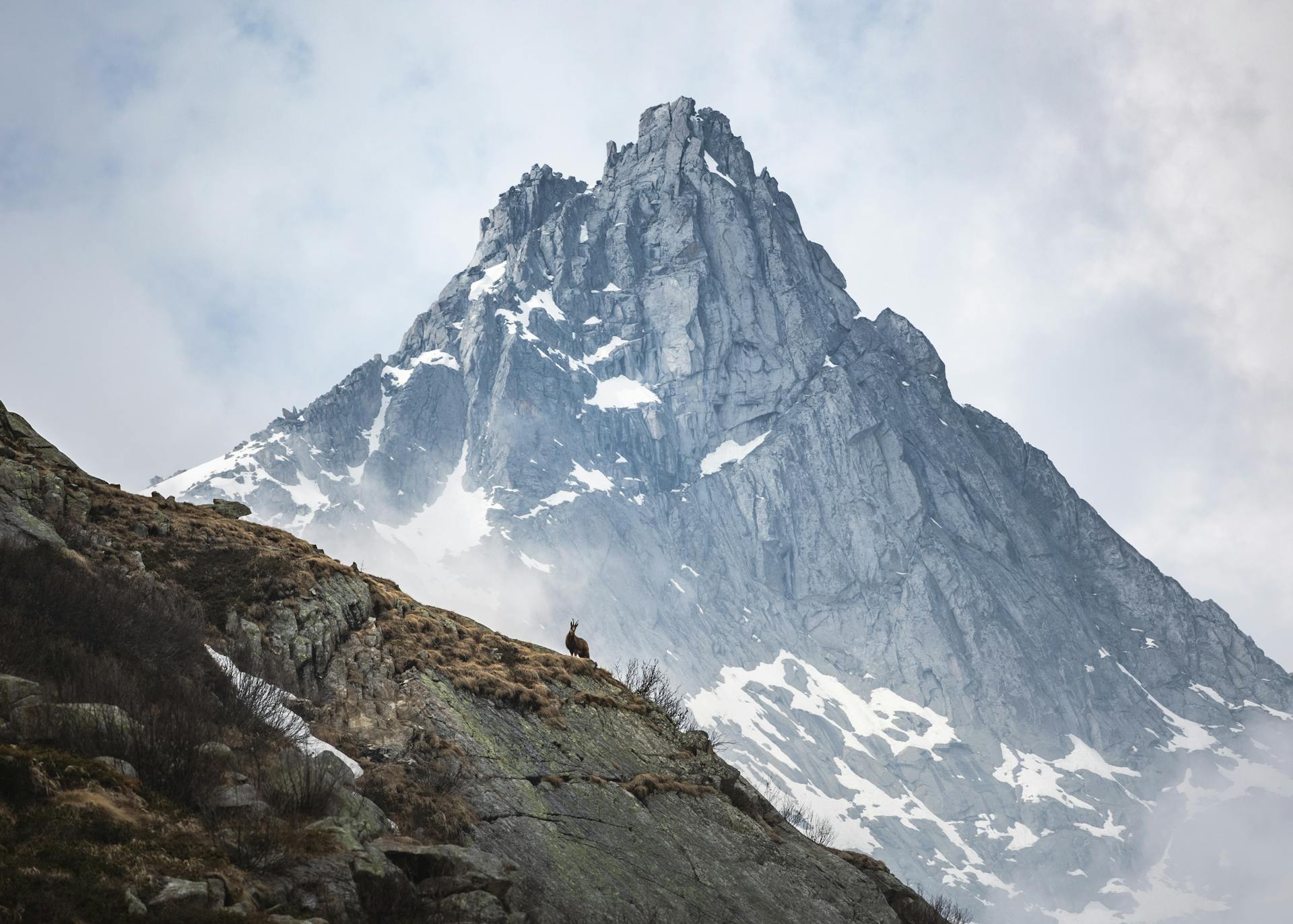
The German Alps are a beautiful region, and the Chiemgauer is a special part of it. The Chiemgauer is a local currency used in the Chiemgau region, which is located in the German Alps.
The Chiemgau region is home to many small towns and villages, including Rosenheim, which is the capital of the Upper Bavarian district of Rosenheim. The region is known for its stunning natural beauty, with towering mountains and picturesque lakes.
The Chiemgauer is a unique currency that can be used for local transactions, and it's a great way to experience the local culture and economy. It's also a fun way to learn about alternative currencies and their benefits.
Chiemgauer System
The Chiemgauer System is a fascinating concept that's been making waves in Germany. It's essentially a local currency, the chiemgauer, which is pegged to the euro.
The idea of a local currency isn't new, as seen in the Austrian town of Wörgl, which issued its own currency in 1932 during the Great Depression. It was so successful that it became known as "das Wunder von Wörgl".
This system allows for alternative ways of doing business and issuing credit outside the banking oligarchy. Josh Ryan-Collins, a senior researcher at the New Economics Foundation, believes that alternative currencies can play a vital role in re-democratizing the monetary system.
The Chiemgauer System is being used in conjunction with information and communication technologies to enable consumers and producers to exchange with each other across a larger area.
Business and Organizations
Nonprofits can purchase 100 Chiemgauer at €97, potentially increasing the value of their money by 3%.
Businesses that accept Chiemgauer are subject to a 5% commission fee if they want to change it back to euros, which incentivizes them to work within the system.
History
The Chiemgauer project has a fascinating history that dates back to 2003. Christian Gelleri, a high school teacher, started this project with his students, who took on various tasks such as designing vouchers, managing administration, and advertising.
The students were in charge of designing and printing vouchers, which is a hands-on approach to learning. This project was inspired by the economists Silvio Gesell and Rudolf Steiner, and by the former's Freigeld.
Here are the key benefits of the Chiemgauer system, which were outlined in the project's early stages:
- Employment creation: unemployed, students, and volunteers are hired to work, earning some allowances
- Promotion of cultural, educational and environmental activities: the Chiemgauer system supports nonprofits who work for such purposes
- Promotion of sustainability: organic food and renewable energy among others
- Strengthening the solidarity: enhancing the human relationship between local shoppers and businesses
- Stimulation of local economy: The Chiemgauer retains purchasing power within the region better than the euro and favors local small businesses, stimulating transactions through demurrage.
- Express-Money: Example for a complementary currency on a national level
In 2006, the "eChiemgauer" was established, which is an electronic form of the Chiemgauer. This was made possible through cooperation with cooperative and local banks.
Demurrage
Demurrage is a form of currency circulation tax that discourages hoarding and stimulates regional economies. It's a clever way to encourage people to spend their money quickly.
Bills of 1, 2, 5, 10, 20, and 50 Chiemgauer have a demurrage system, which requires a 2% tax every three months to keep them valid. This tax is equivalent to €0.10 for a 5 Chiemgauer bill.
The tax is a sticker that needs to be put on the bill, costing 2% of its value. This means that the quicker you spend the money, the less you'll lose in value.
The demurrage system helps combat deflation by increasing the velocity of money. In other words, it encourages people to spend their money faster, which can help boost the economy.
Businesses and Nonprofits
Businesses and nonprofits have different rules when it comes to the Chiemgauer system. Nonprofits can purchase 100 Chiemgauer at €97, potentially increasing the value of their money by 3%.
Businesses that accept Chiemgauer are subject to a 5% commission fee if they want to change it back to euros. This fee incentivizes them to work within the system.
Red Tape
Red Tape can be a real challenge, especially when you're planning a trip to the mountains. Some trails and ski routes are marked within Nature protection areas and can be used in restriction times.
Protection zones are marked on Alpenvereins maps, which are recommended for your visit. The woods west of Aschau im Chiemgau are closed from October 15th to May 31st every year.
Winter protection zones are in effect in some parts north and east of the Hochplatte summit. The Geigelstein Natural Reserve is closed from December 1st to May 31st, with the exception of one marked ski route and most southern ski routes and trails.
Some specific winter protection zones to note are south of Hochgern and Hasenpoint, and the Hochfelln east ridges. The whole Gründberg is closed from November 1st to April 30th every year.
Corridors for ski touring to Dürrnbachhorn are marked, but no trespassing is allowed on the south sides of Dürrnbachhorn and Hochgimpling. The Steinplatte northeast part is also off-limits from November 1st to June 15th.
Guide Books
Guide Books are still available for various mountain ranges.
Bergverlag Rother publishes guide books for the Chiemgau and Chiemsee regions, with 60 and 53 routes respectively. Their books are well-researched and provide detailed route descriptions.
If you're planning a trip to the Bernina Group, Rhaetian Alps, or Hohe Tauern GROUP, you can rely on the guide books from Bergverlag Rother for accurate information.
Here are some of the mountain ranges covered by guide books:
- Bernina Group
- Rhaetian Alps
- Hohe Tauern GROUP
- Presanella Group
- Zillertal Alps
- Dolomites
- Lechtal Alps
- Wettersteingebirge
- Berchtesgaden Alps
- Tux Alps
- Julian Alps
- Niedere Tauern
- Carnic Alps
- Gailtal Alps
- Mieming Range
- Lagorai GROUP
- Lechquellengebirge
- Karwendel
- Cima Bocche (+Group)
- Allgäu Alps
- Kamnik-Savinja Alps
- Kitzbüheler Alpen
- Prealpi Lombarde
- Prealpi Venete e Trentine
- Gurktal Alps / Nockberge
- Tennengebirge
- Lavanttal Alps
- Ennstaler Alpen
- Kaisergebirge
- Ammergau Alps GROUP
These guide books can be a valuable resource for planning your next adventure.
Geography and Maps
The Chiemgauer region is a treasure trove for map enthusiasts, with a variety of top-notch maps available.
For those who love to hike or ski, the Alpenvereinskarte series is a must-have. These maps, such as the BY 17 and BY 18, are incredibly detailed, with trails and ski routes marked, and a UMT-grid for easy navigation. They're available in editions as recent as 2014.
If you're looking for a map that covers a slightly larger area, the Topographische Karten von Bayern (UKL 50-54) is a great option. It features trails and MTB routes, and has a UTM grid for easy navigation, all at a scale of 1:50,000.
Getting There
Getting to the Chiemgauer Alps is relatively easy by car, with a good road infrastructure that makes navigation a breeze. The area is accessible via Highway A 8, which runs along the north side of the area.
The A 8 highway has several exits that give access to different parts of the Chiemgauer Alps. From west to east, these exits are: Highway A 93, which is the Inntal valley highway between Rosenheim and the exit Oberaudorf.
Taking the Austrian road number 172 from the exit Oberaudorf will lead you to Niederndorf, Walchsee, Kössen, and Reit im Winkl, covering the southern parts of the Chiemgauer Alps.
The German road number B 305 connects Reit im Winkl, Inzell, and Schneizlreuth, providing access to the more southeastern part of the mountain area.
German road number B 21 between Schneizlreuth and Bad Reichenhall completes the loop, making it easy to explore the entire area by car.
If you're not driving, the railway connections are a bit limited, with main railway stations located near but not within the Chiemgauer Alps.
Maps
Maps can be a crucial tool for navigating the Chiemgauer Alpen region. The Alpenvereinskarte maps, specifically numbers BY 17, BY 18, and BY 19, are considered the best available, with trails and ski routes included.
These maps are part of the "Alpenvereinskarten digital" edition and have a scale of 1:25,000. They're an essential resource for anyone planning to explore the area.
The Alpenvereinskarte maps are available for the Chiemgauer Alpen West, Mitte, and Ost regions. They're a great starting point for planning your trip.
For a broader view, the Topographische Karten von Bayern, number UKL 50-54, offers a scale of 1:50,000 and includes trails and MTB routes. This map covers the Chiemsee and Chiemgauer Alpen areas.
More maps can be found at Kompass verlag or Freytag & Berndt Verlag, but the Alpenvereinskarte maps are a top choice for exploring the region.
Here's a quick rundown of the maps mentioned:
Berge
The Chiemgauer Berge subrange is a central part of the Chiemgau Alps, located between Marquartstein and Inzell. It's a beautiful area with many peaks to explore.
The highest mountain in the subrange is Hochgern, standing at 1748 meters. You can see the summit from a distance, and it's a great spot for hiking.
Some notable peaks in the Chiemgauer Berge include Ebgelstein, Bairerkopf, and Hochlerch. These mountains offer a range of hiking trails for all levels.
Here's a list of some of the peaks in the Chiemgauer Berge:
The Geigelstein subrange is another notable part of the Chiemgau Alps, located near Aschau.
Geology and Subranges
The Chiemgauer Alps are a part of the Northern Limestone Alps, showcasing different tectonic nappes of the northern Alps rim.
The northernmost tectonic nappe, Helvetikum and Ultrahelveticum, was thrust onto the Alpine foreland sedimentary deposits and can be found at the north rim of Chiemgau Alps. These sediments were deposited on the northern margin of the old Tethys ocean and form many summits and ranges within the Swiss Alps.
The Flysch nappe, mostly sandstones and siltstones, was deposited in the northern Penninic trough in deep water and can be studied north of Ruhpolding.
The main part of Chiemgauer Alpen consists of marls and limestones of the Bavarian and Tirolian Kalkalpin, the deposits of the south margin of Tethys ocean.
The Chiemgauer Alps are divided into several subranges, including the Ruhpoldinger Subrange, which is located in the eastern part of Chiemgau Alps and includes mountains around the town of Ruhpolding. The highest mountain in this subrange is Sonntagshorn.
Here are some of the notable peaks in the Ruhpoldinger Subrange:
- Zinnkopf (1227 m; 4026 ft)
- Vorderer Rauschberg (1645 m; 5397)
- Hinterer Rauschberg (1671 m; 5482 ft)
- Zenokopf (1603 m; 5259 ft)
- Seßseekopf (1153 m; 3783 ft)
Ruhpoldinger Subrange

The Ruhpoldinger Subrange is a beautiful area in the eastern part of the Chiemgauer Alps, surrounding the town of Ruhpolding.
It's nestled between the northern foreland, Weißbach and Saalach valley to the east, Unken / Heutal valley to the south, and Urschlauer Achen valley to the west.
The highest mountain in this range is Sonntagshorn, which stands at an impressive 1961 meters.
You can find a list of the mountains in this range below.
- Zinnkopf (1227 m; 4026 ft)
- Vorderer Rauschberg (1645 m; 5397)
- Hinterer Rauschberg (1671 m; 5482 ft)
- Zenokopf (1603 m; 5259 ft)
- Seßseekopf (1153 m; 3783 ft)
- Ristfeuchthorn (1569 m; 5148 ft)
- Fischbachkopf (1694 m; 5558 ft)
- Reifelberg (1882 m; 6175 ft)
- Sonntagshorn (1961 m; 6434 ft)
- Peitingköpfl (1720 m; 5643 ft)
- Hochgseng (1544 m; 5066 ft)
- Hochgern (1740 m; 5709 ft)
- Aibleck (1756 m; 5761 ft)
- Ochsenhorn (1615 m; 5299 ft)
- Kranzhorn (1241 m; 4072 ft)
- Wendelberg (959 m; 3146 ft)
The whole German part of the Ruhpoldinger Subrange is actually a nature protection area, which is amazing for preserving the natural beauty of this region.
Staufen Subrange
The Staufen subrange is a fascinating part of the Chiemgauer Alps. It's located in the easternmost region of the Alps.
The Staufen subrange is situated between the towns of Bad Reichenhall to the east, Schneizlreuth and its adjacent valleys to the south, and Inzell to the west. The northern boundary is marked by the alpine foreland.
This subrange is home to some impressive peaks, with Zwiesel being the highest at 1781 meters.
The highest peak, Zwiesel, is accompanied by other notable peaks like Mittelstaufen, Zennokopf, and Gamsknogel. Here are some of the notable peaks in the Staufen subrange:
- Hochstaufen (1771 m)
- Mittelstaufen (1680 m)
- Zennokopf (1756 m)
- Zwiesel (1781 m)
- Gamsknogel (1750 m)
- Rabensteinhorn (1363 m)
- Falkenstein (1181 m)
Subranges and Summits
The Chiemgau Alps are a mountain range with several subranges, each with its unique characteristics. The Hochries subrange is located in the western part of the Chiemgauer Alps, with its highest summit being Spitzstein.
The Geigelstein subrange is situated east of Hochries and south of Kampenwand, with Geigelstein being its highest peak. This subrange has a distinct geographical border, with Klausengraben/Dalsenbach valley to the north, Prien valley to the west, Tiroler Achen valley to the east, and Walchsee/Kössen valley to the south.
Here's a list of notable summits in the Geigelstein subrange:
- Geigelstein (1808 m; 5932 ft)
- Weitlahnerkopf (1615 m; 5299 ft)
- Ahornkopf (1540 m; 5052 ft)
- Roßalpenkopf (1762 m; 5781 ft)
- Mühlhörndl (1518 m; 4980 ft)
- Mühlhornwand Wandspitz (1685 m; 5528 ft)
- Latschkogel (1589 m; 5213 ft)
The Ruhpolding subrange is located in the eastern part of the Chiemgauer Alps, surrounding the town of Ruhpolding. Its highest peak is Sonntagshorn, with a height of 1961 meters (6434 ft).
Geology
The Chiemgauer Alpen is part of the Northern Limestone Alps, showcasing a variety of tectonic nappes that make up the northern Alps rim.
The northernmost tectonic nappe, the Helvetikum and Ultrahelveticum, is found at the north rim of Chiemgauer Alpen and was thrust onto the Alpine foreland sedimentary deposits. These sediments were deposited on the northern margin of the old Tethys ocean and form many summits and ranges in the Swiss Alps.
The Flysch nappe, composed of sandstones and siltstones, is mostly found north of Ruhpolding and was deposited in the northern Penninic trough in deep water. This nappe is not very solid and builds up the northernmost and not very prominent ranges of Chiemgauer Alpen.
The main part of Chiemgauer Alpen consists of marls and limestones of the Bavarian and Tirolian Kalkalpin, deposited on the south margin of the Tethys ocean. The Kalkalpin is tectonically divided into several nappes with many intense synclines and anticlines.
The highest peaks of Chiemgauer Alps, such as Sonntagshorn and Reifelberge, are mainly built of Hauptdolomit, a dolomite rock formed in huge lagoons and mudflats of the old Tethys ocean.
Weitlahnerkopf is formed from late Triassic and early Jurassic deposits, while coral and limestone algae reef remnants of Wettersteinkalk can be studied at Kampenwand or Gurnwandkopf.
Sources
- https://en.wikipedia.org/wiki/Chiemgauer
- https://www.theguardian.com/money/2011/sep/23/local-currencies-german-chiemgauer
- https://www.resilience.org/stories/2019-07-22/cool-currencies-the-chiemgauer/
- https://www.socioeco.org/bdf_fiche-document-1501_en.html
- https://www.summitpost.org/chiemgau-alps/993012
Featured Images: pexels.com